FULL REPORT
The full report is approximately 110 pages and rich with detail. The compressed PDF is 4.7 MB.
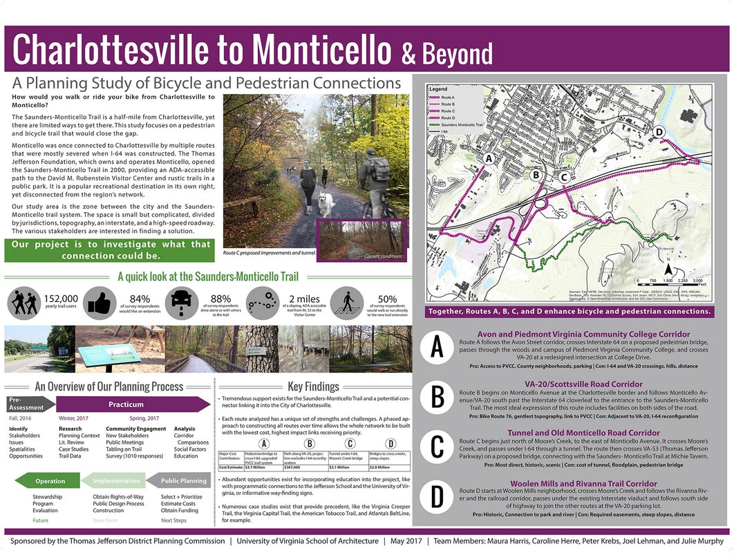
PROJECT POSTER
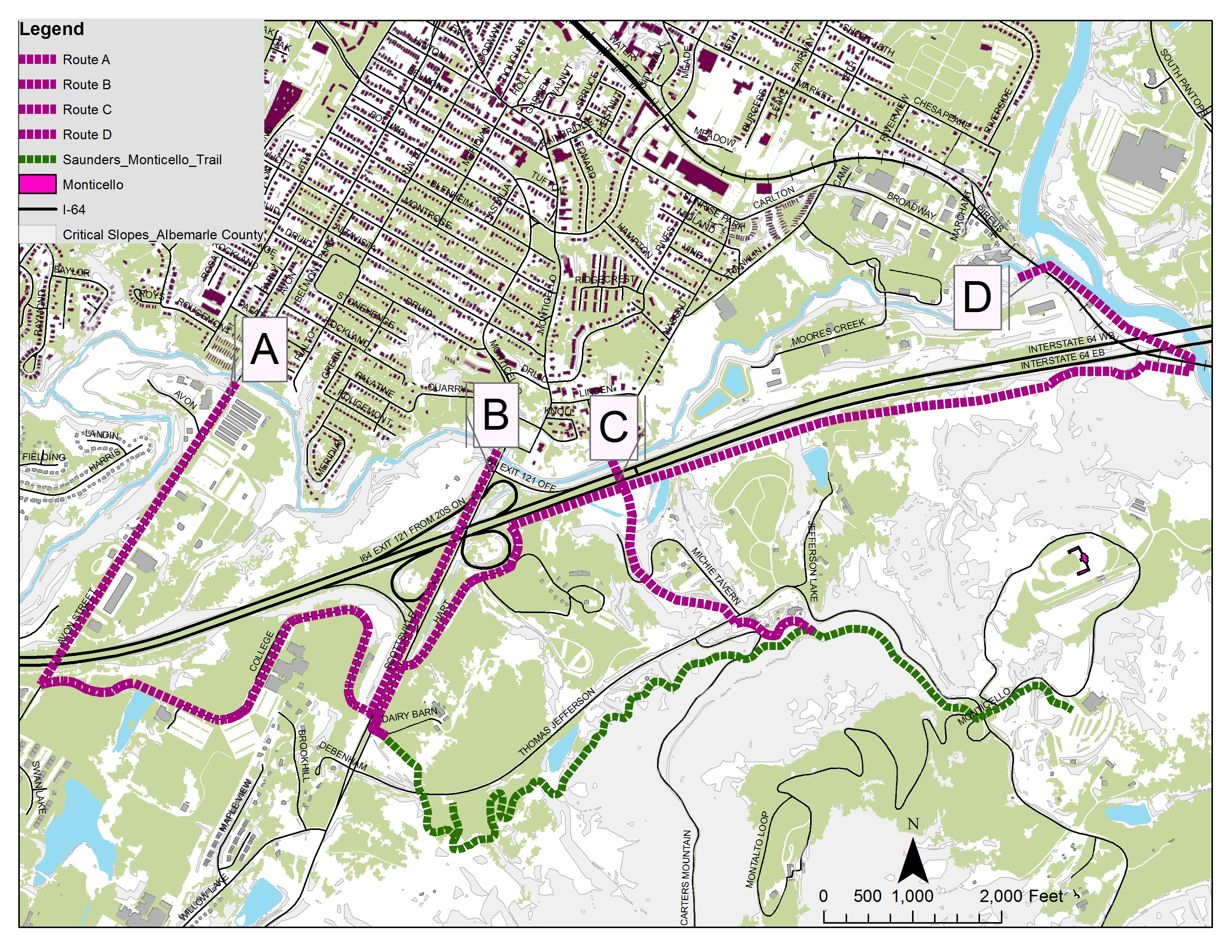
ALL ROUTES MAP
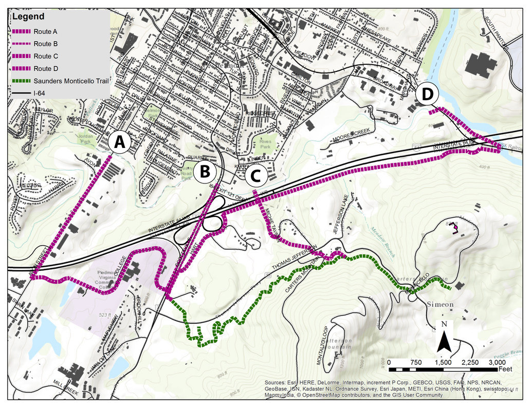
Downloadable map of the four study-area corridors.
ASSESSMENT REPORT
The Pre-Assessment, which identifies stakeholders, issues and opportunities and evaluates the Planning environment is also available for download (1.7 MB).
Graph: Mentions of users' thoughts and suggestions for trail connectivity. There is a related post on the blog, excerpted from the report.
